Signposting
As El Caminito del Rey is in a protected natural area, all signposting has been design according to the Natural Areas Signposting Manual from the Andalucia Council. Furthermore, every indication from the Environmental Agents and the Spanish military police, exercising their duties will be mandatory.
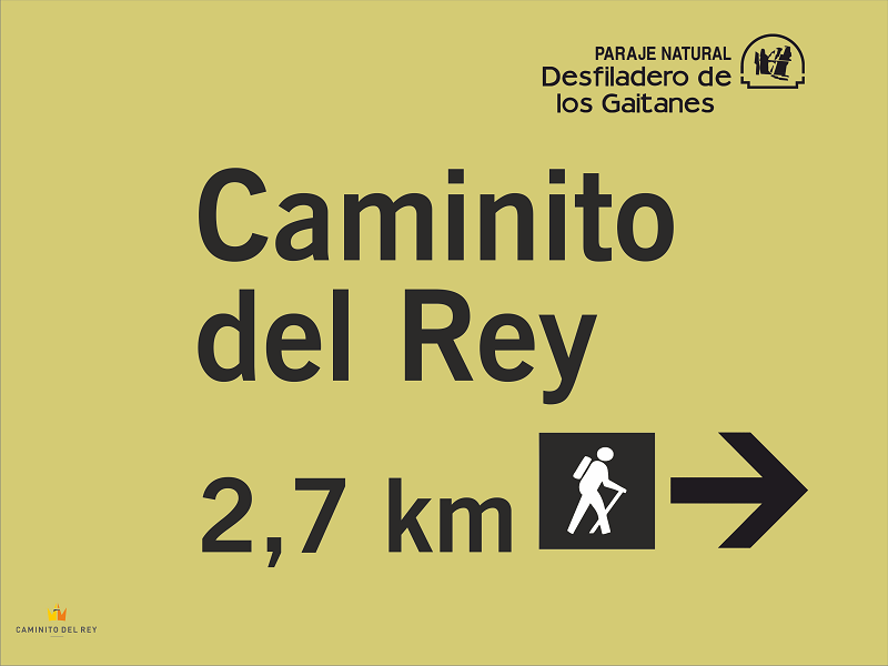
Location signposting (big format)
The ones at the start of the path, there to inform of the distance left to reach El Caminito, the ones indicating where to find the control cabins or how many people can be somewhere at a specific time (For example, no more than 4 people in crystal floored balconies or 10 people to go through the hanging bridge at the Gaitaines).
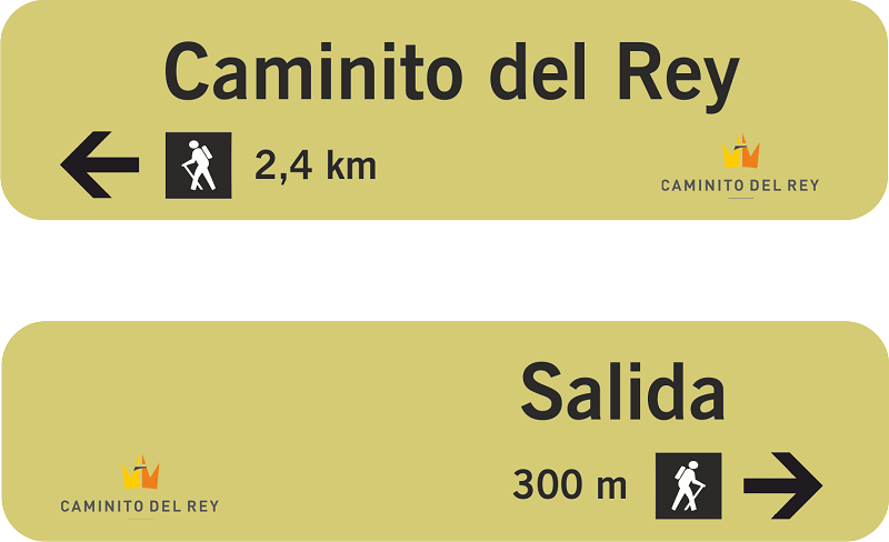
Guidance signposting (small arrow-like format)
The ones placed on the two paths entry crossings.
Complimentary signposting
The ones that indicate the start and end of the path through the northern and southern accesses.
Start/End of path signal
Situated before the entries and exits of the path.
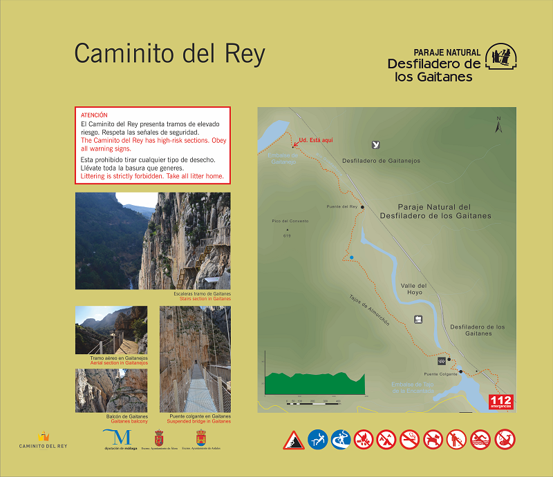
These signals include different logos indicating danger, prohibition or precaution as well as the logos of El Caminito and official institutions.
Theme signposting
The ones that refer to the flora, wildlife or native geology.
Public use signposting
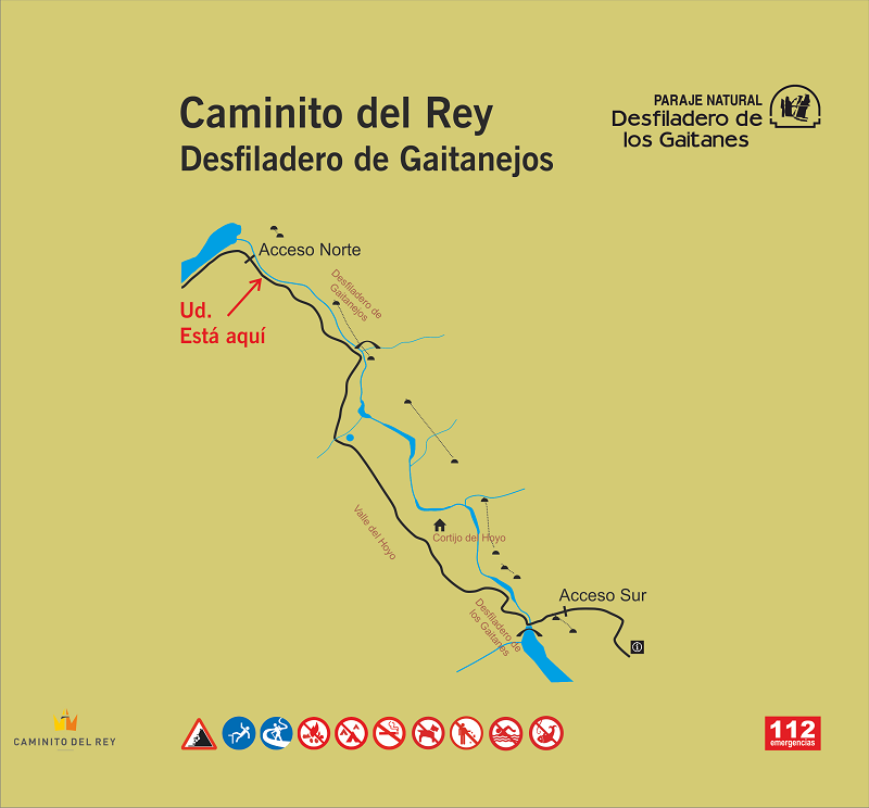
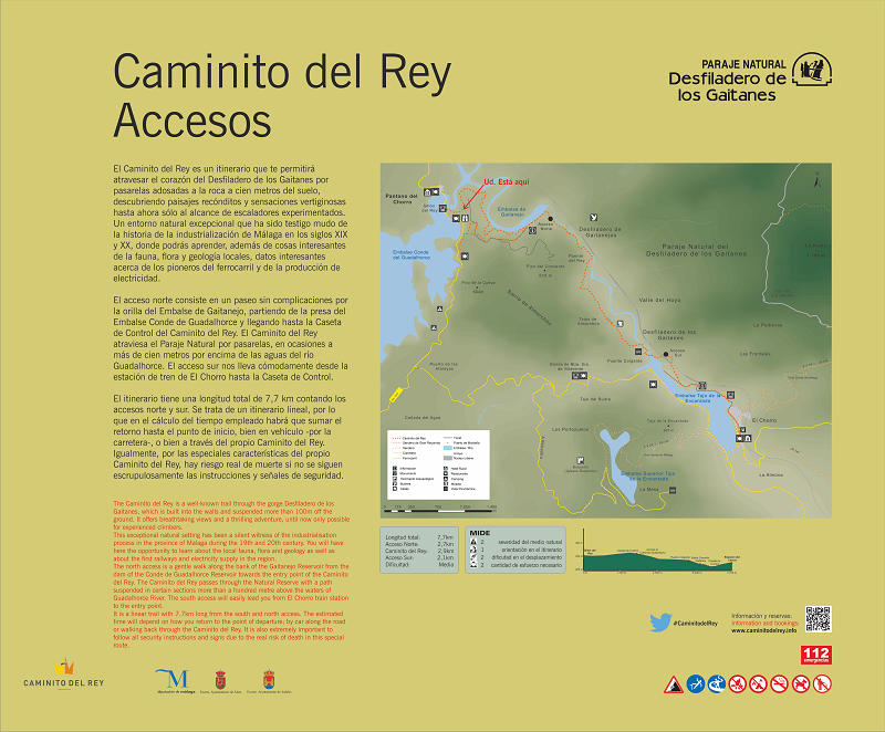
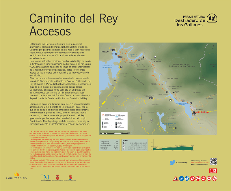
These are signs that offer general information in spanish and english about the itinerary and its access points, a map with the distances between each segment, the longitudinal pofile of the route, the reference to the MIDE method, a detailed map of the area with: information points, dams, tunnels, hotels, restaurants, viewpoints, camping sites or roads as well as the place the visitor is at that point. The respective signal is the access one (there are two, Northern access and Southern access)
Starting on the Northern access, the following sections can be seen
- Northern Entry/Exit to Gaitanejos
- Gaitanejos
- El Valle del Hoyo
- Gaitanes
- Southern Entry/Exit to Gaitanejos
The "Caminito del Rey", located in the Desfiladero de los Gaitanes Natural Park, is situated in the centre of the province of Málaga, less than 60 km from the capital. It is bordered to the north by the Serranía de Ronda and the Llanos de Antequera, and to the south by the Guadalhorce Valley and the historic region of Campo de Cámara.